
South Crete Travel Guide: Villages, Beaches, History, and Practical Tips
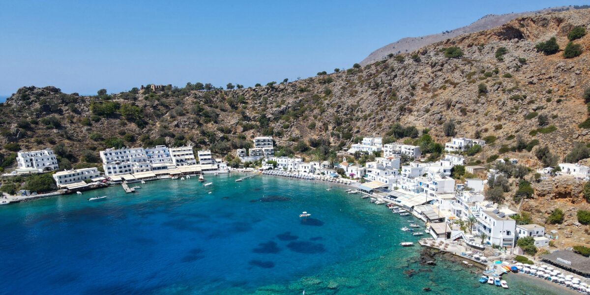
South Crete does not reveal itself in one sweeping viewpoint.
It appears gradually as the road crosses a mountain pass, a gorge opens toward the Libyan Sea, and the landscape becomes drier, steeper, and less built up. The distances on a map can look modest, but the drive south changes the rhythm of a trip. Large resorts become less common. Villages are smaller. Roads follow the land rather than cutting directly through it.
For travelers visiting in July, this side of the island offers a practical alternative to the busiest northern hubs. It is not empty, and well-known places such as Matala and Preveli still draw summer visitors, but the region gives you more ways to step away from crowds. A morning in a mountain village, an early archaeological visit, and a late swim can all fit naturally into the same day.
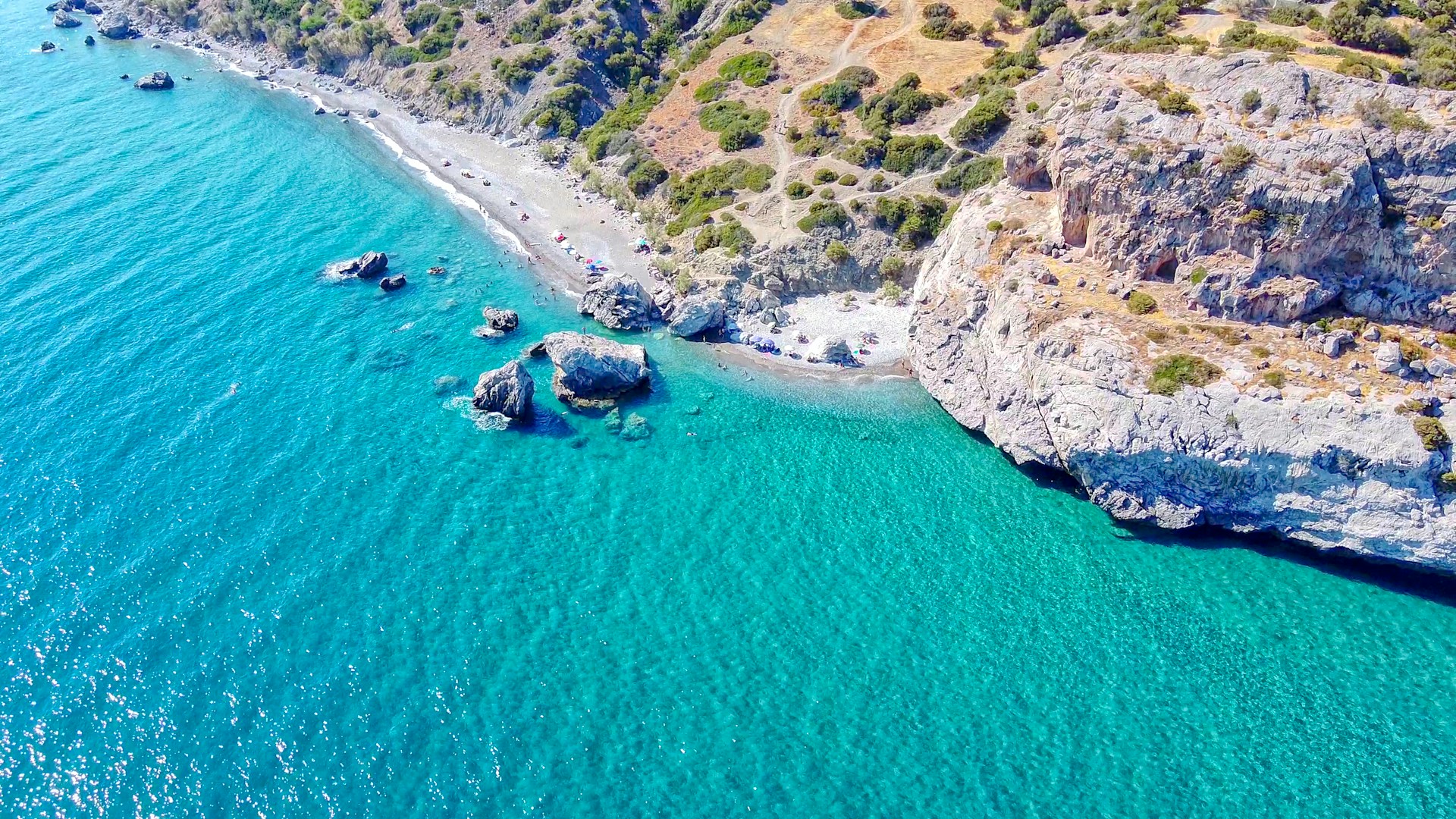
Photo by Evangelos Mpikakis on Unsplash
Quick Answer: Is South Crete Worth Visiting?
Yes. South Crete is worth visiting if you value independent villages, dramatic landscapes, clear-water beaches, local food, and archaeological depth. Its essential stops include Sfakia, Loutro, Matala, Agia Galini, Phaistos, and the Amari Valley. Plan for winding roads, limited public transportation, and longer driving times than the map suggests. In western Sfakia, ferries are part of the transport network because several coastal settlements have no road access.
Why South Crete Feels Different
The White Mountains, Psiloritis, and the Dikti range separate much of the south coast from Crete’s main northern road. That geography has protected distinct communities and produced a coastline of gorges, small bays, open beaches, and settlements reached by narrow mountain roads. The Libyan Sea also gives the coast a strong physical presence. On calm days it can be glassy and intensely clear. When the wind rises, conditions change quickly.
South Crete is not one compact destination. The southwest around Sfakia and Loutro feels different from the central coast around Plakias, Matala, and Agia Galini, while the southeast toward Ierapetra and Xerokampos has its own distances and character. Trying to cover the entire coast in a few days usually means too much time in the car. Choose one or two areas and explore them with patience.
If you are traveling during peak season, begin with the practical overview in Crete in July. It explains the heat, busy periods, and daily timing that affect every south-coast plan.
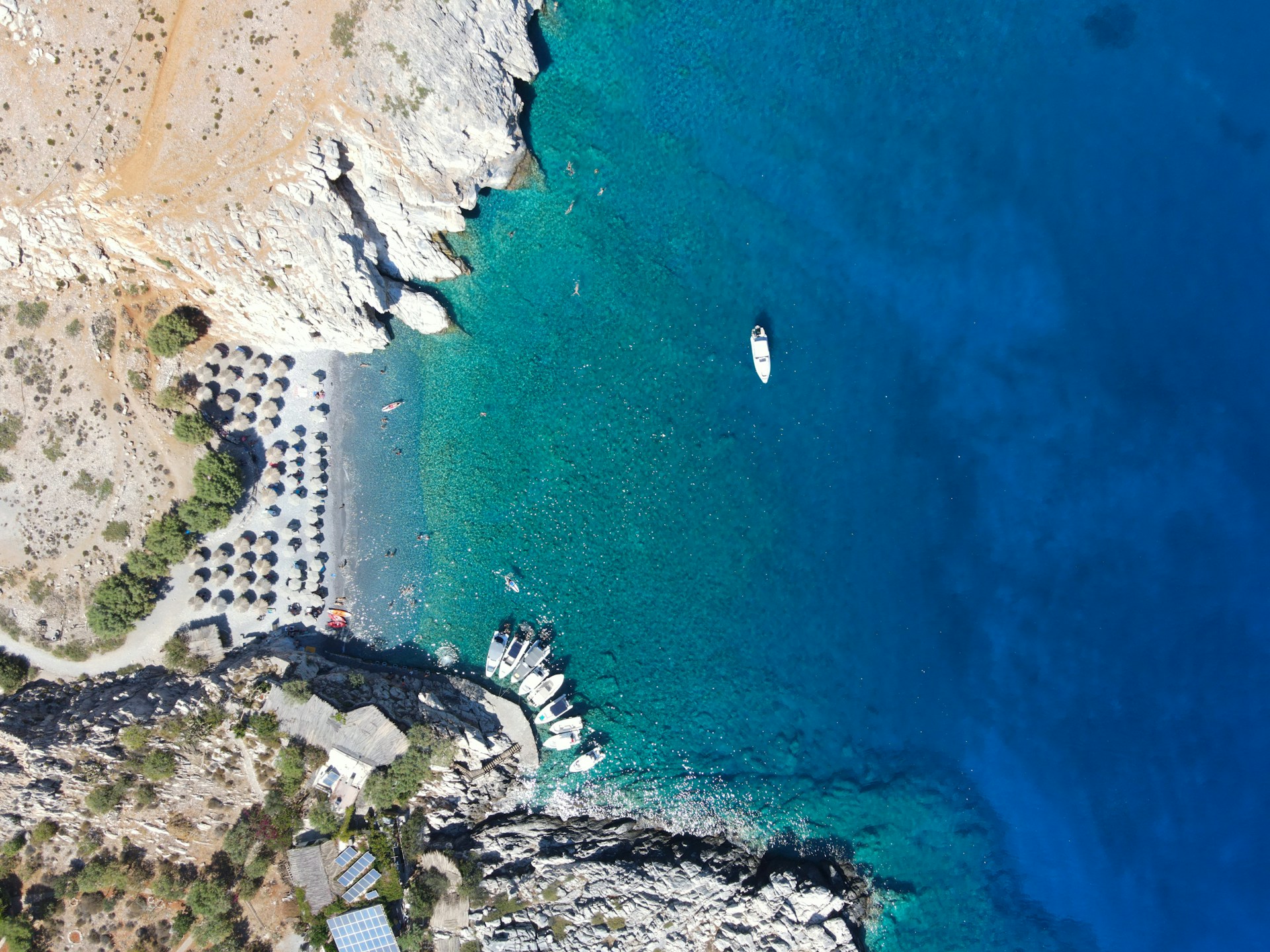
Photo by Dimitris Kiriakakis on Unsplash
The Best Places to Visit in South Crete
Sfakia: A Region Shaped by Independence
Sfakia is both a historical region and a living cultural identity. The high mountains, deep gorges, and difficult access helped its communities maintain a fierce independence through periods of occupation and conflict. That history still matters locally, but Sfakia should not be reduced to a romantic story of resistance. It is also found in family ties, pastoral life, music, hospitality, and food.
Chora Sfakion is the practical coastal center. Ferries leave from its harbor for Loutro, Agia Roumeli, Sougia, and Paleochora on scheduled routes. Before boarding, try a sfakiani pita, the region’s thin cheese pie served with honey. It is simple food with a precise local identity.
The landscape is inseparable from its walking routes. Our guide to the gorges of Crete gives broader context, while the dedicated Imbros Gorge article covers one of Sfakia’s most accessible historic paths.
Loutro: A Car-Free Harbor
Loutro is a small whitewashed village set around a protected turquoise bay. There is no road into the settlement, so you arrive by ferry, water taxi, or on foot. That absence of cars changes the experience immediately. Deliveries come by boat, the waterfront acts as the main street, and the village is quietest after day visitors leave.
Loutro is best treated as more than a photo stop. Stay long enough to swim early, walk part of the E4 coastal path, or take a small boat to nearby beaches such as Glyka Nera or Marmara when sea conditions allow. In July, book accommodation and ferry seats ahead, and keep plans flexible if strong wind affects sailings.
Matala: Caves, Counterculture, and a Busy Summer Beach
Matala is one of the south coast’s most recognizable places. Rock-cut caves line the sandstone cliff beside the beach. Many began as Roman-period tombs, although the site is widely associated with the international travelers who lived in some caves during the 1960s and early 1970s. The modern village embraces that countercultural chapter with murals, music, and colorful signs.
Matala is lively rather than hidden, especially in July. Visit the caves early, then explore nearby Kommos Beach or continue inland toward the Messara Plain. The contrast between popular Matala and the ancient landscape around Phaistos makes this part of south Crete especially rewarding.
Agia Galini: A Low-Key Harbor on the Libyan Sea
Agia Galini climbs the hillside above a small harbor east of the Messara Gulf. It has enough restaurants, rooms, and services to work as a base, yet its scale remains manageable. The steep lanes reward slow exploration, and the harbor is pleasant in the evening after beach traffic eases.
The town suits travelers who want access to central south Crete without staying in its busiest resort areas. From here, you can reach the Amari Valley, Triopetra, Agios Pavlos, Matala, and Phaistos by car, though each involves winding roads and realistic drive times.
Amari Valley: The Inland Alternative
The Amari Valley is not on the coast, and that is precisely why it belongs in a thoughtful south Crete itinerary. Between Psiloritis and Mount Kedros, villages sit among olive groves, orchards, Byzantine churches, and cultivated slopes. Summer days here revolve less around beach schedules and more around village squares, local kitchens, and the relationship between farming and mountain life.
Amari offers relief from the visual and logistical intensity of the coast. It also adds context. Crete’s southern identity is not only maritime. It is agricultural, pastoral, and shaped by sacred sites that have been used, abandoned, remembered, and revisited across centuries. Dress respectfully when entering churches, avoid photographing worshippers without permission, and remember that many small monuments have irregular opening arrangements.
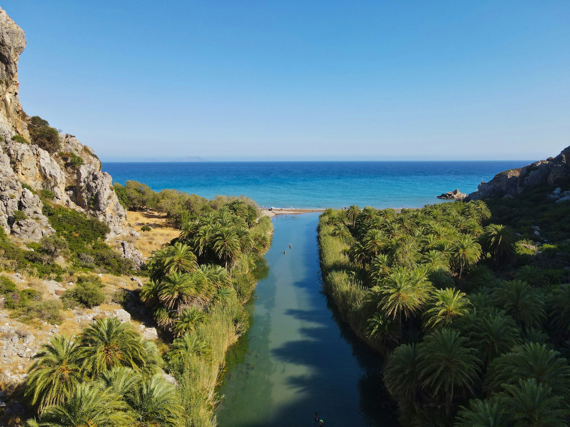
Photo by Dimitris Kiriakakis on Unsplash
Hidden Beaches and Wild Swimming
Travelers often search for south Crete beaches hidden from mass tourism, but access is what keeps many of them quiet. Some require a boat, a walk, an unpaved road, or a careful descent. Glyka Nera sits between Chora Sfakion and Loutro and is reached on foot or by boat. Marmara, at the mouth of Aradena Gorge, is another boat-access favorite. Farther east, the long shores around Triopetra, Ligres, and Agios Pavlos provide more space than compact resort beaches.
Remote does not mean risk-free. Shade may be scarce, mobile reception can be inconsistent, and afternoon winds can make return boat journeys uncomfortable or impossible. Carry water, sun protection, proper footwear, and enough time to return before dark. Ask locally about sea conditions rather than relying only on a forecast app.
For one south-coast landscape where river, palm forest, monastery, and beach meet, read the complete guide to Preveli Beach. It deserves its own visit, but it should not stand in for the entire region.
History, Archaeology, and Sacred Landscape
The south was never peripheral to ancient Crete. The Messara Plain supported major Minoan centers, agricultural production, and routes toward ports on the Libyan Sea. Phaistos occupies a ridge with wide views across this landscape. Its architecture is less heavily reconstructed than Knossos, allowing the plan, courts, stairways, and setting to speak more clearly.
Plan an early visit with the detailed Phaistos Palace guide, then place the site within the island’s wider network through our overview of archaeological sites in Crete.
This landscape also invites a more reflective reading. Across Crete, caves, peaks, springs, and fertile ground carried sacred meaning long before later churches and monasteries occupied prominent places. For travelers interested in the Divine Feminine, the value lies in approaching these places with historical care rather than projecting modern ideas onto the past. Minoan imagery gives women a striking ritual presence, but interpretations should remain open, evidence-based, and attentive to what archaeology can and cannot tell us.
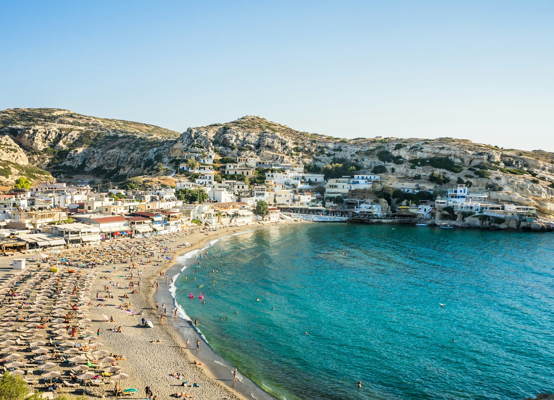
Photo by Leonhard Niederwimmer on Unsplash
How to Travel Around South Crete
A Car Is Essential for Most Routes
A rental car is the most useful way to explore central and eastern south Crete and the inland valleys. Public buses serve selected towns, but schedules are not designed for flexible village hopping. Roads are generally paved on main routes, although they are often narrow and winding. Avoid planning several cross-island drives on consecutive days.
Do not assume that two places close together on the map are connected by a fast coastal road. Mountains and gorges often force routes inland. Fill the fuel tank before remote drives, download offline maps, and avoid unpaved shortcuts unless your vehicle agreement permits them.
Ferries Are Part of the Roadless Southwest
Scheduled coastal ferries connect Paleochora, Sougia, Agia Roumeli, Loutro, and Chora Sfakion on varying routes. They are essential for villages such as Loutro and Agia Roumeli, which do not have normal road access. Timetables change by season and weather, so confirm the current schedule directly before travel. Build a buffer into any plan tied to a flight or a long drive.
A Practical Five-Day South Crete Itinerary
- Day 1: Cross the White Mountains to Chora Sfakion. Stop in the highlands, walk the harbor, and learn the practical ferry layout.
- Day 2: Take the morning ferry to Loutro. Swim, walk a section of the coastal path, and stay overnight if your schedule allows.
- Day 3: Return to your car and drive toward central south Crete. Choose a quiet beach near Plakias, Triopetra, or Agios Pavlos rather than stacking several stops.
- Day 4: Visit Phaistos early, continue to Matala, and leave time for the wider Messara landscape rather than only the beach.
- Day 5: Spend the day in the Amari Valley, visiting villages, churches, and a local taverna before returning north or continuing to Agia Galini.
With only three days, choose either Sfakia and Loutro or Matala, Phaistos, and Amari. Combining both clusters is possible, but it turns a short trip into a sequence of transfers.
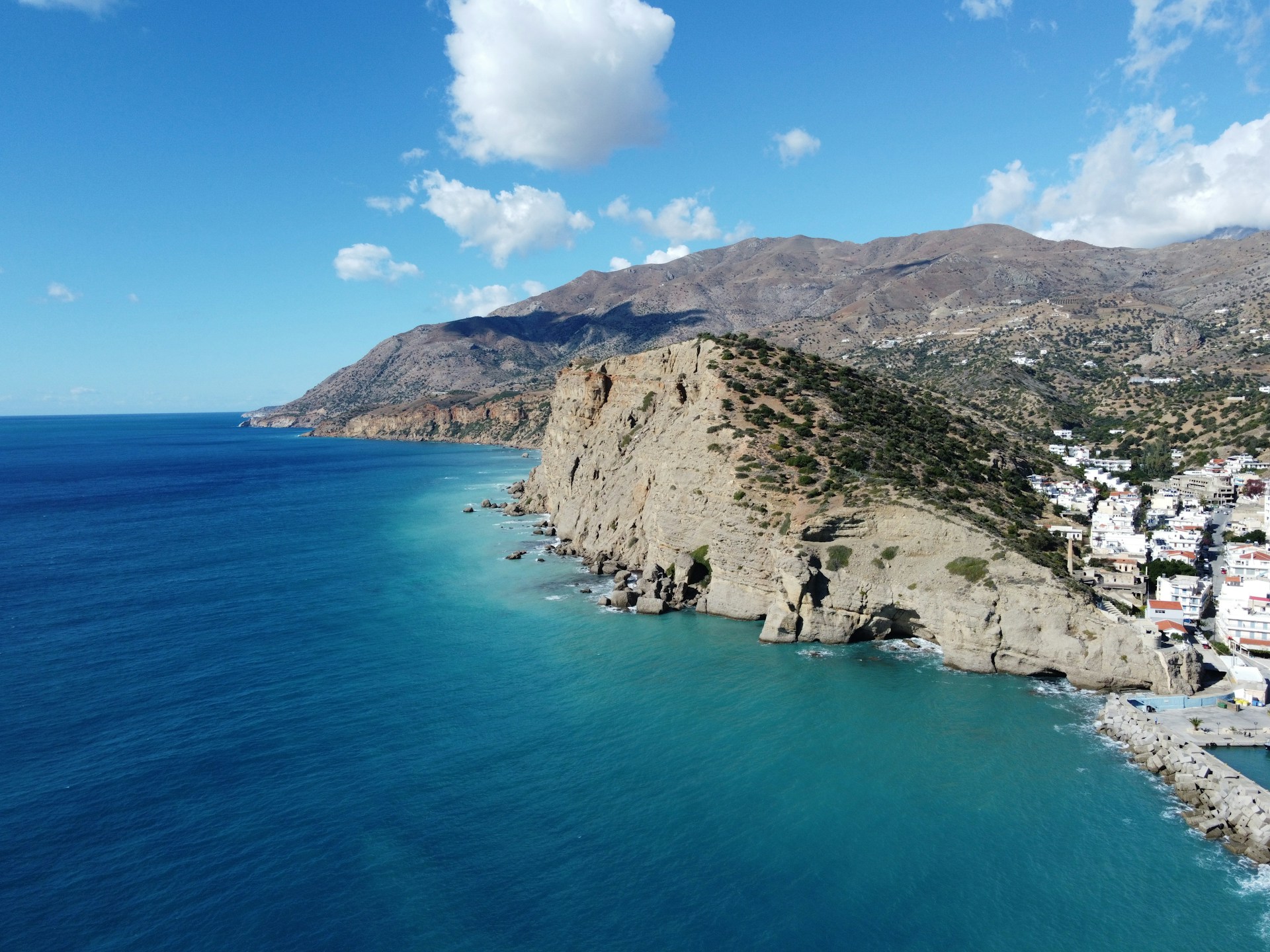
Photo by STEFANOS KERAMARIS on Unsplash
When to Visit, Where to Stay, and What to Know
June and September offer warm seas with somewhat lighter demand. July and August bring dependable swimming weather, long daylight, and the greatest pressure on well-known beaches and rooms. In peak summer, start archaeological visits and walks early, reserve small hotels ahead, and leave the hottest hours for lunch, rest, or a shaded village stop.
Choose Chora Sfakion or Loutro for the roadless southwest; Plakias for services and access to central beaches; Matala for energy, history, and the Messara Plain; Agia Galini for a comfortable harbor base; or an Amari village for inland calm. A split stay often works better than driving back and forth across the mountains.
For a broader planning list before you choose a base, review these things to do in Crete and select experiences that belong naturally in the same region.
Conclusion: Let the South Coast Set the Pace
A good south Crete travel guide should help you choose, not encourage you to collect every destination. The coast rewards fewer bases, earlier starts, and room for weather to change a plan. Sfakia carries a powerful regional identity. Loutro shows how access can shape a village. Matala connects archaeology with modern cultural memory. Agia Galini offers an easy harbor rhythm, while Amari brings the inland world of olives, churches, and mountain food into the journey.
Taken together, these places reveal a side of Crete that is quieter without being empty, culturally rich without needing spectacle, and best understood through time spent on the ground.
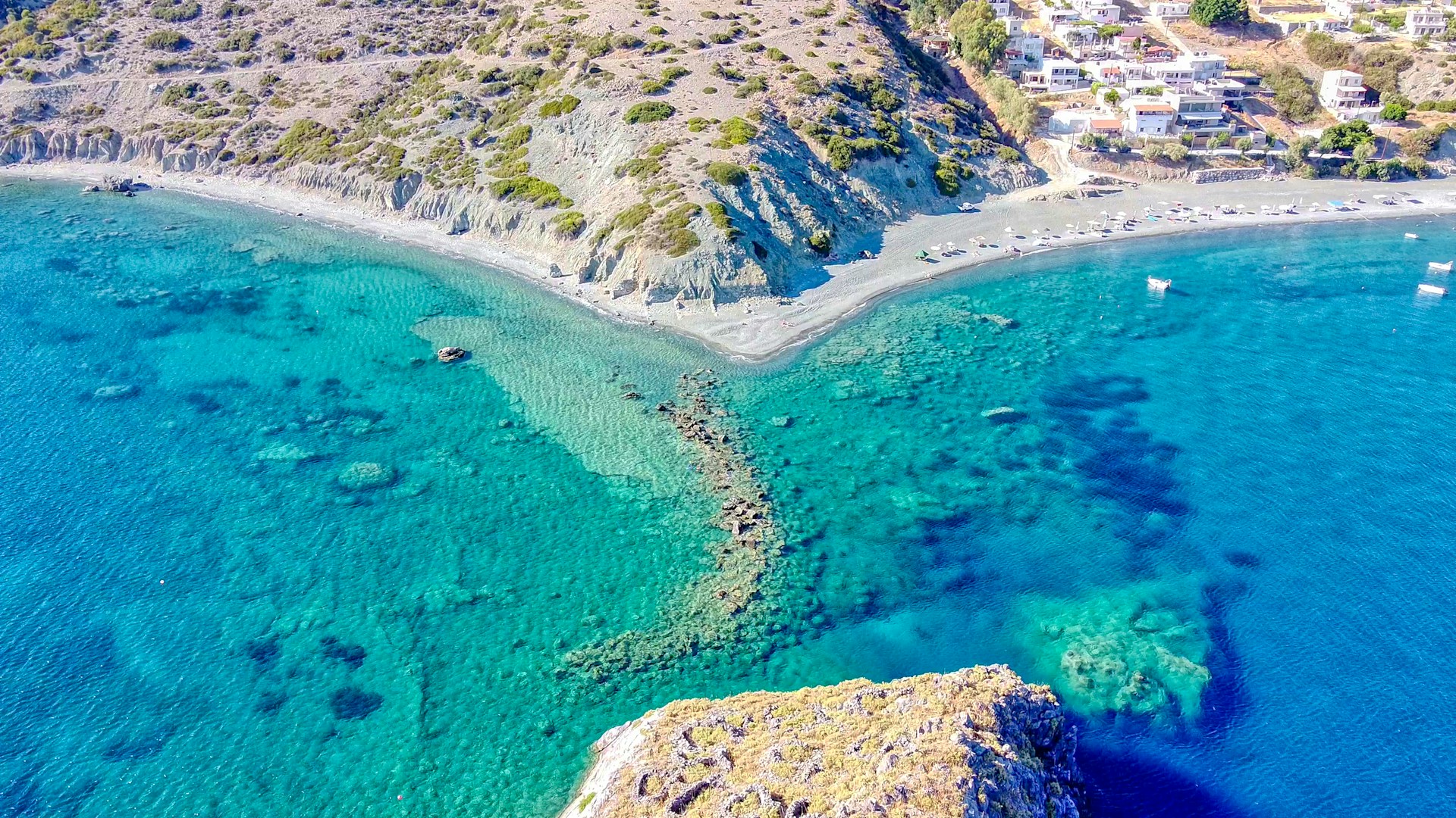
Photo by Evangelos Mpikakis on Unsplash
Frequently Asked Questions
What is considered south Crete?
South Crete broadly refers to the island’s Libyan Sea coast and its adjoining inland regions, from the southwest around Paleochora and Sfakia through Plakias, Matala, Agia Galini, Ierapetra, and the southeast. It is a long, varied region rather than one resort area.
What are the best villages in south Crete?
Sfakia, Loutro, Matala, and Agia Galini are strong first choices, each with a different character. Inland villages in the Amari Valley add traditional food, Byzantine churches, and agricultural landscapes.
Do you need a car in south Crete?
Yes, a car is highly recommended for most of south Crete. It gives access to inland villages, archaeological sites, and remote beaches. In the roadless southwest, coastal ferries replace the road for Loutro, Agia Roumeli, and nearby beaches.
Is south Crete less crowded in July?
It is often less concentrated than the north coast, but famous places such as Matala, Preveli, and Loutro can still be busy. Visit popular sites early and use smaller beaches and inland villages during peak hours.
How many days do you need for south Crete?
Allow at least four or five days for one or two clusters. A week gives enough time to combine Sfakia and Loutro with central destinations such as Phaistos, Matala, Agia Galini, and Amari without rushing.
Can you visit Loutro by car?
No. Loutro has no road access. You can reach it by scheduled ferry, water taxi, or on foot along the coastal trail.
Feature photo by Dimitris Kiriakakis on Unsplash